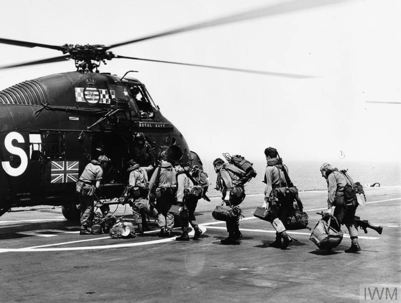
The wind has been sitting to the west for most of the winter so we’ve not had many opportunities to play in the nearby race at Angus Rock which requires a south easterly, but last weekend it whipped around for two days. The tide however wasn’t quite right so we headed out before sunrise to see if we could catch the last of the ebb, we usually play at the beginning of the ebb so it could have been a dud but turned out to be decent enough especially considering it was neaps. The first test of the new Delphin 150,shame I was too knackered to drive it, must work on fitness!
A picture below of Greg getting eaten then spat out, looked impressive

Hopefully the wind will shift from the west and we can get out here more this year and recruit some extra volunteers, anyone up for it?
Tags: Angus Rock, Belfast Kayak Club, Delphin, Northern Ireland, Strangford Lough, Tide Race
My previous post was about mapping and I failed to point out a pretty neat interactive map on the CanoeNI web site. They currently have a lot of information about the South East Coast Canoe Trail as they call it which stretches from the mouth of Strangford Lough down to Carlingford Lough along with a detailed map of get ins, facilities and interesting information along the way.
http://www.canoeni.com/canoe-trails/south-east-coast/
There are more coastal trails to cover the rest of the coast in the pipeline along with inland water way trails already written and general river/surf/sea paddling locations around Northern Ireland. Printed trail information can be requested from the web site or downloaded as PDFs from here.
It’s a great resource for anyone wanting to paddle in Northern Ireland whatever your taste.

So with a new baby on the go I’ve not been getting out much, one of the things I’ve been messing with is mapping options for reporting trips and displaying pictures of sea kayaking around Northern Ireland and further afield. I’ve used WordPress plugins where possible as it simplifies things a lot but the Google mapping APIs are quite easy to use directly.
A simple GPS track with XML Google maps using a GPX file:
Geotagging of images and displaying on a map again with XML Google maps, creating the KMZ file requires a GPS track and images time synced, there are a few ways of doing this with this plugin and the map below may require zooming in:
Geocoding information has been added using WP Geo to all posts on the blog along with an overall map of all posts linked to at “Map” in the blog title bar using WP Geo Big Map which is pretty neat and gives a visual guide to the blog posts, still working on the presentation. There’s also a sidebar widget displaying the location of posts on the current page too.
I’ve also looked at community mapping to see what could be done to put together a community edited site for tide races/interesting bits of water after setting up a map tide races I know of around Ulster linked here. It allows collaboration if anyone’s interested in using it to pull together maps from multiple users using their Google accounts. The mapping toolbar (example) as used in the Google map allows areas and lines to be added as well as pointers which would be quite handy for detailed mapping.
An embedded small non editable version below:
Ulster Tide Races in a larger map
Going further it looks a nice project to put together a community editable mapping site for interesting water locations using one of the popular CMS systems to allow adding and editing of features on a map as well as linking imaging, videos, discussions, local paddlers etc. Not sure there’s enough people interested in paddling in interesting water interested in sharing local information for this to be of any use but if the paddling drought keeps up I might end up doing it to see how its done, along with buying an Ergometer!
And check out the Map at the top of the blog or here.
Tags: geotagging, maps
Rich and Gethin have recently finished their Ulster Circumnavigation by sea kayak raising money for Macmillan Cancer Support. Starting from Crawfordsburn on the County Down coast they rounded the coast until they reached the River Fane where they then took to the non salty stuff to do the inland waterway crossing (including a long portage on trolly) before exiting on the west coast of Ireland to carry on the salty bit around to the north and back to Crawfordsburn sixteen days later.
They have just uploaded the first of their pictures and no doubt they will have some more pictures and details about the trip soon on their web site http://www.ulstercircumnavigation2011.co.uk/
It’s not often you see a fiberglass sea kayak in this terrain!

Tags: Ulster Circumnavigation
No longer on Mull we move on to the more bit! Although the plans had us carrying on kayaking around Mull, the forecast was shocking so we found ourselves back in Oban just in time for a decent spring tide ebb at the Falls of Lora, I think this was the way it was meant to be, thank you wind
We had hoped there might be others around to give breaking in and wave location pointers for some newbies but unfortunately no-one was about so we ended up just brute forcing the options with not much success. The three of us had a play about for a couple of hours with a couple of swims thanks to the whirlies playing havoc with the roll, great fun and we will be back.
Later in the day we headed down to Cuan to set off for Scarba and arrived late on in the evening with some food caught by Will & Greg on the run down that was enjoyed later on. It took an almighty push to get around the corner against the tide in to the bay on the south east corner against the tide, not something I would have liked to try if tired.
One of us opted to have a rest day due to an injury so two of us planned to paddle out through the gulf and return the following night to pick him up. At least that was the plan but with a late departure and F5-6 westerly against the tide our plans changed shortly after departure when we seen dark shadows across the front of long waves in the direction we were going at the other side of the Gulf. We made the decision to turn about and head back against the tide while we still could, it just didn’t feel right having left one of our party behind and as it was the first sunny day we had seen the whole trip we could make it a hiking day instead
I manager to kink the skeg cable on landing so spent a short while sorting it out before taking a hike right along the south coast to see the Corryvrecken in full flow with a strong opposing wind and returning up high making the best of the sunny weather. Later on once inside the bothy the heavens opened and the winds increased so we were mighty glad we had turned back and were not sitting inside a tent or worse.
The return to Cuan was an interesting rough crossing back from Scarba with a couple of large yachts taking pictures of us nutjobs, no doubt they were thinking we looked vulnerable while we were looking at them thinking rather you than me getting rolled about like that!
A quick run up the sound of Shuna had us back at Cuan slip on the way home after a very cool 9 days paddling in near constant rain and wind. Had the weather been sunny and calm the trip wouldn’t have been anywhere near as interesting. That said, I would like to experience sun and no wind next time
- Mull & More Day 1-3 Ross of Mull
- Mull & More Day 4-6 Ulva, Staffa, Gometra
- Mull & More Day 7-9 Falls of Lora, Scarba
Tags: corryverckan, Falls of Lora, Scarba, Scotland
The plan for the next three days was to paddle out to Staffa day 1 and spend the night on Ulva or Gometra with the possibility of heading to the Treshnish Islands. Again however the forecast was having none of this with strong winds and rain forecast so the plan was out but we still managed the day 1 plan in the biggest seas of the week, after that we decided not to push it too much for the next two days!
The paddle out to Ulva found large rolling swell between it and Inch Kenneth, it wasn’t unfriendly so provided a fun roller coaster ride across. We hid from the wind a little by paddling in to Craigaig Bay and then made our way out to Staffa after a lunch stop on Little Colonsay to get out of the wind.
The visibility was terrible and Staffa was not initially visible, so we were happy to have it appear out of the murk after 15 minutes of paddling. The breakers were obvious as soon as the island was in sight so no caves today, I did say hello to a rock though would have been rude not to get a scar on the kayak on a day like this! We did however round the exposed south west of the island and slowly picked our way through the skerries and made our way up the west coast whilst trying to avoid being surfed.
The paddle downwind back to Little Colonsay was quick with the following wind and then on to Ulva and Gometra, by this point I was cold having been wet most of the day and in the driving rain and wind I was fantasising about being out of the elements in a tent. On arrival on the shore we must have looked a poor lot and were very fortunate to be offered accommodation which we of course accepted, it lifted my cold wet spirit so much I was smiling ear to ear, thanks again for this!
After getting fed and dried the wind stopped, the rain stopped, the sun came out and sea flattened. Staffa looked tantalisingly close and calm compared to earlier but it just wasn’t to be. We got a good view of the large blow hole shooting high in to the air across the bay, we had heard and seen it loudly earlier in the evening when passing by on the water.
After the paddle the day before we thought a change of pace was in order so spent the day rounding Gometra and Ulva with a convenient stop off at the Boathouse for food, wine and a bit of Geocaching (Spot the TB!) The paddle back in to the wind around the south coast of Ulva was pushy but we returned to base on Gometra for a second night in great company.
With the forecast talking of gales out to the west, the next day was to be a paddle back to the car to find shelter. We decided to take the shelter between the two islands and paddle the north of Ulva on the return leg allowing us to stay sheltered from the strong south westerlies. A bit better timing on the tide might have helped prevent me getting stuck in the mud trying to rush a kayak portage with a fast outdoing tide!
A stop in by the boathouse was obviously a necessity for some cake and biscuits before the paddle back to the car located at Clachandhu across the forecast wind which was just horrible and like pushing weights, we were very happy to get to wet land. The rain didn’t let off and hammered us until we were fully packed and back in the car on the way to Oban for the next few days kayaking.
With holidays booked months ago the three of us watched the heat wave and the low winds knowing that this was likely our summer being used up, and right enough approaching the time of departure the weather turned! So Friday the 13th of May with a relatively foul forecast was as good a day to start on the proposed nine day kayaking trip to Scotland. The original plan put together by myself was a “little” over ambitious, so was tweaked a lot on the ferry with the horrible forecast in our hands.
Our set off point would remain the same, Carsaig Bay, on the south coast of the Ross of Mull leaving options to retreat/move elsewhere dependent on the weather.
This being our first longish trip it took us a bit of time to pack the boats with the kitchen sinks despite pre-departure practice, there was still time for a pre-set off rest though.
With the afternoon fast running out we set off around the coast immediately being impressed with the cliffs, rocks and formations along the way, the wind and swell however made things rather hard and put pay to the idea of stopping at the arches. With the light beginning to dim and stomachs beginning to complain we pushed in to a small sandy bay with flat camping spots about 5km short of our intended stopping point and commenced our first, and last, nights wild camping.
One of us forgetting tent poles lead to some amusement, thankfully there was a tarp but with the snoring situation unknown at this stage, tent sharing was only going to be in an emergency!
The second day was to be a day of two halves, strong wind one half and really strong wind the other half. Dipping out of the wind for lunch we entered a lovely sheltered bay where from the pictures you would assume it was a glorious sunny day, on leaving the bay the wind was still unfortunately there waiting for us. A nice paddle all the same but we were glad to find a very windswept Fidden camp site to pitch tents get warmed up in and walk to a bar for a drink or three where we met a large group of kayakers also enjoying wind swept Mull. This was our last night camping full stop
The third day was a lot better, with the F5+ winds still on us and heavy rain in our faces yet again we pushed across the sound to Iona. The west coast of the island turned out to be spectacular with some little races and interesting spots with the large swell pushing through livening things up a lot. Stopping for lunch on a sandy offshore group of rocks on the north west coast we watched Iona and cooled down rapidly, some sun wouldn’t have gone amiss at this point.
For the afternoon paddle we faced an interesting prospect, a tail wind! Even with stopping to take in some of the caves and sites along the coast we managed to cover more distance in the half day than in the previous day and a half with the head wind. This took us right back to the road leading to Carsaig Bay to collect the car, find a b&b, get fed and more importantly get out of the heavy rain!
- Mull & More Day 1-3 Ross of Mull
- Mull & More Day 4-6 Ulva, Staffa, Gometra
- Mull & More Day 7-9 Falls of Lora, Scarba
Tags: Carsaig Bay, Iona, Mull, Scotland
What better way to make one of your regular paddles more interesting, do it on a moonless night. Oh, and just to make it that little bit more interesting, use a Greenland paddle for a change.
A paddle out around the main Copeland island from Donaghadee is a short local paddle across Donaghadee sound. The sound has a decent tidal flow that can be interesting or flat calm. Total time required two hours or so.
A call in to inform the coastguard was made as there was a rescue of kayakers in distress here two days before so prudent in case people were a bit 999 happy. The local coastguard are really friendly and encourage trip plans to be logged. The conversation started off with a quizzical response of “Kayaks, in the dark??” to the plans which made me smile, an addition to those that think kayakers are a strange bunch
On approaching the eastern corner we hit the first bit of playful water. With no moonlight reactions mostly came from the feel of the water instead of seeing it, making what would in the daylight be of little interest, exciting. The only annoyance was the Mew island lighthouse, this resulted in me counting all the way up the side of the island in order to ensure I had my eyes shut every time the beam tried to blind me. Once side on to it, things improved and the light just lit up the North side of Copeland searchlight style.
It may seem obvious but rocks are totally invisible in the dark, like scarily invisible. For me the following ways helped identify rocks:
- By watching how the the water is behaving, this was the most obvious giveaway, calm patches were usually waiting for a bit of swell before becoming very un-calm or in the lee of an invisible rock.
- Hitting it, obvious, but not good for the gelcoat.
- Waiting until your picked up by a wave breaking over the shelf then you can be sure a rock is near, and getting closer!
Or, you could just be sensible and go well wide to avoid them completely.
The paddle around the western side of the island back to Donaghadee was a lot more lumpy with waves occasionally breaking over the deck, this in the dark whilst paddling with a wooden stick your not that used to really does to add up to create a new experience somewhere familiar. We were heading for an unlit basket marker at a point on the mainland shore where there is a small tidal race. Just as I asked Rich if he could see the basket yet I felt the water change and knew we were in front of the beacon, feeling where you are in the water without seeing it is something new. The race is a very small patch and during the day and you’d just have a short play while passing but the night gave it a new dimension which had all the senses at max.
I would thoroughly recommend a night paddle as a way to give a regular paddle a new edge.
To finish the black dark evening off we had an appropriate dark pint of Guinness in Grace Neills which might have been the best I’ve had to date..
Tags: Copeland, Donaghadee, Night Paddle, Northern Ireland


